Checkout Päijänne National Park Watch Video
Päijänne National Park
Located in the areas of Asikkala, Padasjoki and Sysmä, in Päijät-Häme region.
- The park covers an area of 16 square kilometers and was established in 1993.
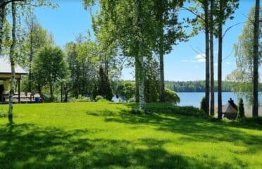
- The park is located in the southern part of the second largest lake in Finland, Päijänne.
- The area includes about 50 undeveloped islands and wildlife and parts of the inhabited islands. Some of the islands are sandy gray islands, some are rocky and moraine islands. The most important tourist destinations are the largest island Kelvenne and Pulkkilanharju.
- Since the park is mainly located on the islands, most of the park is accessible only by water. Kelvenne, with its many lagoons, is a popular boating destination. Haapasaari has the building of the last fishery farm in South Päijänne.
- The surrounding areas have several guest stages and excursion and guest harbours.
- The Emblem of Päijänne National Park is Lesser Black-backed Gull.
- The starting point of the Pulkkilanharju nature trail (2 km) is by the Karisalmi bridge. The trail introduces hikers to the origins and vegetation of the esker. The area has several marked hiking trails (2–30 km), from easy to medium-demanding.
- The islands in the national park are popular berry-picking destinations.
- Excellent water areas for canoeing and rowing, canoeing routes, campfire sites and camping sites on islands.
- Road 314 from Vääksy to Sysmä, via Pulkkilanharju Ridge, is ideal for cycling.
- Ice conditions permitting, you can skate and wind sledge among the islands.
- Ice conditions permitting, the Padasjoki local authority maintains a 14 km cross-country skiing trail on the ice of Lake Päijänne.
- The natural sandy beaches on Kelvenne island are ideal for swimming. Sun worshippers love the 700 metre Isohieta beach. There is no official beach.
- In summer, Päijänne National Park is suitable particularly for visitors by water. No accessible services.
You can leave your review at the bottom of this page! Enjoy your visit!


